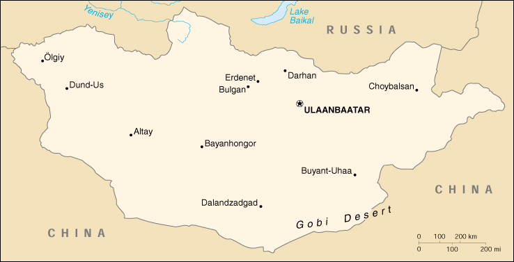
 Location Northern Asia, between China and Russia
Geographic coordinates 46 00 N, 105 00 E
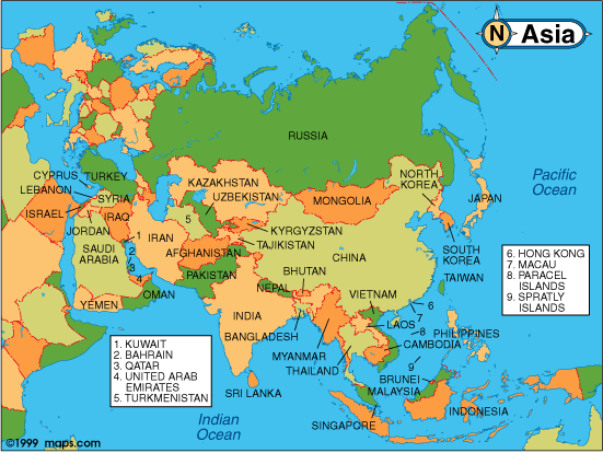
Map references Asia
Area total:1.565 million sq km
land:1.565 million sq km
water:0 sq km
Area - comparative slightly smaller than Alaska
Land boundaries total:8,114 km
border countries:China 4,673 km, Russia 3,441 km
Coastline 0 km (landlocked)
Climate desert; continental (large daily and seasonal temperature ranges)
Terrain vast semidesert and desert plains; mountains in west and southwest; Gobi Desert in southeast
Elevation extremes lowest point:Hoh Nuur 518 m
highest point:Tavan Bogd Uul 4,374 m
Natural resources oil, coal, copper, molybdenum, tungsten, phosphates, tin, nickel, zinc, wolfram, fluorspar, gold
Land use arable land:1%
permanent crops:0%
permanent pastures:80%
forests and woodland:9%
other:10% (1993 est.)
Irrigated land 800 sq km (1993 est.)
Natural hazards dust storms can occur in the spring; grassland fires
Environment - current issues limited natural fresh water resources; policies of the former communist regime promoting rapid urbanization and industrial growth have raised concerns about their negative effects on the environment; the burning of soft coal in power plants and the lack of enforcement of environmental laws have severely polluted the air in Ulaanbaatar; deforestation, overgrazing, the converting of virgin land to agricultural production have increased soil erosion from wind and rain; desertification and mining activities have also had a deleterious effect on the environment
Environment - international agreements
party to:Biodiversity, Climate Change, Climate Change-Kyoto Protocol, Desertification, Endangered Species, Environmental Modification, Hazardous Wastes, Law of the Sea, Nuclear Test Ban, Ozone Layer Protection, Wetlands
signed, but not ratified:none of the selected agreements
Geography - note landlocked; strategic location between China and Russia LANDFORMS
The terrain is one of mountains and rolling plateaus, with a high degree of relief. Overall, the land slopes from the high Altai Mountains of the west and the north to plains and depressions in the east and the south. Hutyen Orgil (sometimes called Nayramadlin Orgil--Mount Friendship) in extreme western Mongolia, where the Mongolian, the Soviet, and the Chinese borders meet, is the highest point (4,374 meters). The lowest is 560 meters, an otherwise undistinguished spot in the eastern Mongolian plain. The country has an average elevation of 1,580 meters. The landscape includes one of Asia's largest freshwater lakes (Hovsgol Nuur), many salt lakes, marshes, sand dunes, rolling grasslands, alpine forests, and permanent montane glaciers. Northern and western Mongolia are seismically active zones, with frequent earthquakes and many hot springs and extinct volcanoes.
Mongolia has three major mountain ranges. The highest is the Altai Mountains, which stretch across the western and the southwestern regions of the country on a northwest-to-southeast axis. The Hangayn Nuruu, mountains also trending northwest to southeast, occupy much of central and north-central Mongolia. These are older, lower, and more eroded mountains, with many forests and alpine pastures. The Hentiyn Nuruu, mountains near the Soviet border to the northeast of Ulaanbaatar, are lower still. Much of eastern Mongolia is occupied by a plain, and the lowest area is a southwest-to-northeast trending depression that reaches from the Gobi region in the south to the eastern frontier. The rivers drain in three directions: north to the Arctic Ocean, east to the Pacific, or south to the deserts and the depressions of Inner Asia. Rivers are most extensively developed in the north, and the country's major river system is that of the Selenge-Moron, which drains into Lake Baykal. Some minor tributaries of Siberia's Yenisey River also rise in the mountains of northwestern Mongolia. Rivers in northeastern Mongolia drain into the Pacific through the Argun and Amur (Heilong Jiang) rivers, while the few streams of southern and southwestern Mongolia do not reach the sea but run into salt lakes or deserts.
CLIMATE
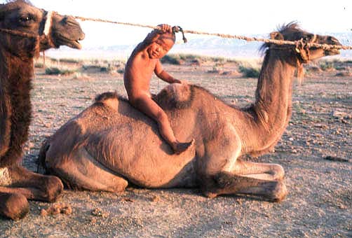
Mongolia is high, cold, and dry. It has an extreme continental climate with long, cold winters and short summers, during which most precipitation falls. The country averages 257 cloudless days a year, and it is usually at the center of a region of high atmospheric pressure. Precipitation is highest in the north, which averages 20 to 35 centimeters per year, and lowest in the south, which receives 10 to 20 centimeters. The extreme south is the Gobi, some regions of which receive no precipitation at all in most years. The name Gobi is a Mongol meaning desert, depression, salt marsh, or steppe, but which usually refers to a category of arid rangeland with insufficient vegetation to support marmots but with enough to support camels. Mongols distinguish gobi from desert proper, although the distinction is not always apparent to outsiders unfamiliar with the Mongolian landscape. Gobi rangelands are fragile and are easily destroyed by overgrazing, which results in expansion of the true desert, a stony waste where not even Bactrian camels can survive.
Average temperatures over most of the country are below freezing from November through March and are about freezing in April and October. January and February averages of -20 C are common, with winter nights of -40 C occurring most years. Summer extremes reach as high as 38 C in the southern Gobi region and 33 C in Ulaanbaatar. More than half the country is covered by permafrost, which makes construction, road building, and mining difficult. All rivers and freshwater lakes freeze over in the winter, and smaller streams commonly freeze to the bottom. Ulaanbaatar lies at 1,351 meters above sea level in the valley of the Tuul Gol, a river. Located in the relatively well-watered north, it receives an annual average of 31 centimeters of precipitation, almost all of which falls in July and in August. Ulaanbaatar has an average annual temperature of -2.9C and a frost-free period extending on the average from mid-June to late August.
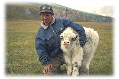
Mongolia's weather is characterized by extreme variability and short-term unpredictability in the summer, and the multiyear averages conceal wide variations in precipitation, dates of frosts, and occurrences of blizzards and spring dust storms. Such weather poses severe challenges to human and livestock survival. Official statistics list less than 1 percent of the country as arable, 8 to 10 percent as forest, and the rest as pasture or desert. Grain, mostly wheat, is grown in the valleys of the Selenge river system in the north, but yields fluctuate widely and unpredictably as a result of the amount and the timing of rain and the dates of killing frosts. Although winters are generally cold and clear, there are occasional blizzards that do not deposit much snow but cover the grasses with enough snow and ice to make grazing impossible, killing off tens of thousands of sheep or cattle. Such losses of livestock, which are an inevitable and, in a sense, normal consequence of the climate, have made it difficult for planned increases in livestock numbers to be achieved.
|